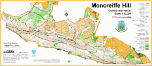
Local Event, Moncreiffe Hill

Sun 10th May 2015
Last updated: 11th May
Type of event: Local
Type of terrain: Forest
Read more about the mapped area
Results
Info
Fantastic turn-out today at Moncreiffe in spite of the rain! Most of you were still smiling at the finish, well done! It was great to see such so many club members and new faces. We hope to see you at our next event!
Location
Nearest town: Bridge of Earn
- Grid Ref: NO138209
- Postcode: PH2 8QJ
- Latitude: 56.37323
- Longitude: -3.39538
- Google Map (aerial)
- Bing Map (OS)
- OpenStreetMap
Pre event information
Directions / Parking
Parking and assembly will be signposted from the Perth to Rhynd road, north of Moncreiffe Hill, and about 2km east of the junction with the A912 Edinburgh Road.
- From the west, north and Dundee directions, follow signs to Perth City Centre. Leave Perth by the A912 Edinburgh Road, and at the top of the hill, just before the M90 junction, turn left for Rhynd.
- From the south, leave the M90 at junction 10, following signs for A912 Perth. Immediately after the end of the slip road, turn right for Rhynd.
Registration & Start Times
Registration will be open from 10:00.
Starts will be available until 12:30.
Course Information
There will be a range of courses to suit all ages and abilities:
| Course | Approx length (km) |
|---|---|
| Yellow | 2 |
| Orange | 3 |
| Green | 4 |
| Blue | 6 |
All beginners under 12 should be accompanied by an adult.
SportIdent (Si) electronic punching will be used. Si cards will be available to hire if you don't have your own.
Explanation of colour courses
- White are very easy with all controls on paths. They are mainly used by 6-10 year olds and family groups.
- Yellow use simple linear features like paths, walls and streams. They are mainly used by under 12’s and family groups.
- Orange progress to basic use of the compass and route choice. They are ideal for novice adults or experienced youngsters.
- Light Green are ideal for improvers as the navigational difficulty begins to increase and uses simple contours and point features.
- Green are used mostly by experienced under 18’s and adults wanting a short but challenging course with a very hard navigational difficulty.
- Blue are a longer, more physically demanding course in comparison to the green. The distances are more varied between controls and the course attracts experienced orienteers.
- Brown & Black are very physically demanding and have a very hard navigational difficulty. They are for experienced orienteers only.
- Score means visiting as many controls as possible in any order in a specific time, like 45mins.
Entry Details
Entry fees:
- Seniors: £4 (non-members of British Orienteering £5)
- Juniors: £2 (non-members of British Orienteering £2.50)
- Family groups: £5 (for one map)
You can turn up on the day and maps will be available (though we can't guarantee they will be available for the course you want). To be sure of getting a map for your preferred course, we strongly recommend you email the organiser in advance with your map requests: Fernandoquintiliani@yahoo.co.uk.
Contacts / Officials
Event planner/organiser: Fernando Quintiliani (phone 07519 392099 or email )
Event controller: David Frame
Safety and Risk
A comprehensive risk assessment will have been carried out by the organiser, but participants take part at their own risk and are responsible for their own safety during the event.
Keep It Clean campaign - Forestry Commission Scotland
Our forests are at risk from tree pests and diseases. These can dramatically affect the health of our trees, upsetting the delicate ecosystem balance and devastating large areas of woodland.
Pests and diseases hitch a ride in mud and debris on shoes, paws and tyres, ending up in new forests. Here, they can spread rapidly in environments with no natural resilience.
Read more about this on the FCS website.
Privacy
When entering our events your name may appear in the results section of this website or in newspaper reports.
Read our privacy policy to see how we look after your personal data.