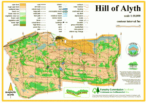
Hill of Alyth
Location
Nearest town: Alyth
- Grid Ref: NO237503
- Postcode: PH11 8LD
- Latitude: 56.64265
- Longitude: -3.24593
- Google Map (aerial)
- Bing Map (OS)
- OpenStreetMap
Terrain description
An area of open hillside, with surprisingly complex contour detail, a good network of paths and an intricate pattern of gorse to add to the navigational challenge! Great views south over Alyth town towards Strathmore, and north to the foothills of the Grampian Mountains.
The Cateran Trail, a long-distance footpath, crosses the area in a north-south direction.
Very close to Hill of Alyth is another of our mapped areas - Den of Alyth. Both maps were produced with the support of the Alyth Hill Users Group.
Image Gallery
Click the image for a larger version.
