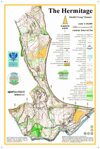
The Hermitage
Location
Nearest town: Dunkeld
- Grid Ref: NO012422
- Postcode: PH8 0JR
- Latitude: 56.56103
- Longitude: -3.60898
- Google Map (aerial)
- Bing Map (OS)
- OpenStreetMap
Terrain description
The lower south east slopes of Craigvinean Forest, where there are the famous tourist attractions of Ossian’s Cave and the Hermitage, plus a folly and the Pinecone Viewpoint linked by a path network. The area is mainly open conifer woodland in the north with good rock detail.
A large area of cleared windblow means the area is now most suited for limited colour-coded events.
The Hermitage also includes a Woodland Challenge permanent course.
Image Gallery
Click the image for a larger version.
