Tullochroisk

Location
Nearest town: Kinloch Rannoch
- Grid Ref: NN712579
- Postcode: PH16 5QF
- Latitude: 56.69285
- Longitude: -4.10440
- Google Map (aerial)
- Bing Map (OS)
- OpenStreetMap
Terrain description
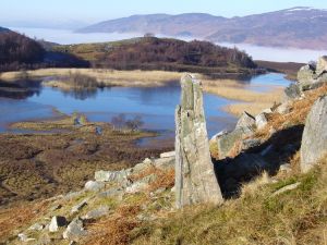
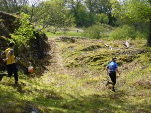
One of our very best areas. Stretching from the northern slopes of Schiehallion down to the River Tummel, Tullochroisk is classic Highland Scottish orienteering terrain - combining challenging open moorland with areas of natural deciduous woodland, and to the southwest, an area of mature, runnable coniferous plantation with excellent contour detail throughout.
Tullochroisk's quality shows in the events it has hosted - including the JK 2000 Relays, the Scottish Championships in 2008 and Day 3 of the Scottish 6 Days in 2009.
Image Gallery
Click the image for a larger version.