Dundurn

Location
Nearest town: St Fillans
- Grid Ref: NN250701
- Postcode: PH6 2NJ
- Latitude: 56.39054
- Longitude: -4.10714
- Google Map (aerial)
- Bing Map (OS)
- OpenStreetMap
Terrain description
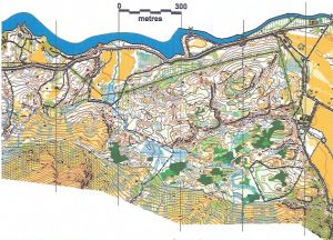
Complex area of forest at St Fillans (West Perthshire)
Image Gallery
Click the image for a larger version.