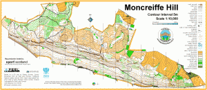
Moncreiffe Hill

Location
Nearest town: Perth
- Grid Ref: NO154193
- Postcode: PH2 8QL
- Latitude: 56.36680
- Longitude: -3.40566
- Google Map (aerial)
- Bing Map (OS)
- OpenStreetMap
Terrain description
A long east-west hill with a variety of tree cover, much of it managed by the Woodland Trust. Moncrieffe Hill has steep southern flanks with crags very visible from the M90 motorway, and just a few ways down, but more gentle northern slopes which are a mix of open and wooded land offering good orienteering with an adequate path network. There are two iron-age hill forts in the area.
Moncreiffe Hill has hosted a full colour coded event and the Scottish round of the Compass Sport Trophy.
Image Gallery
Click the image for a larger version.